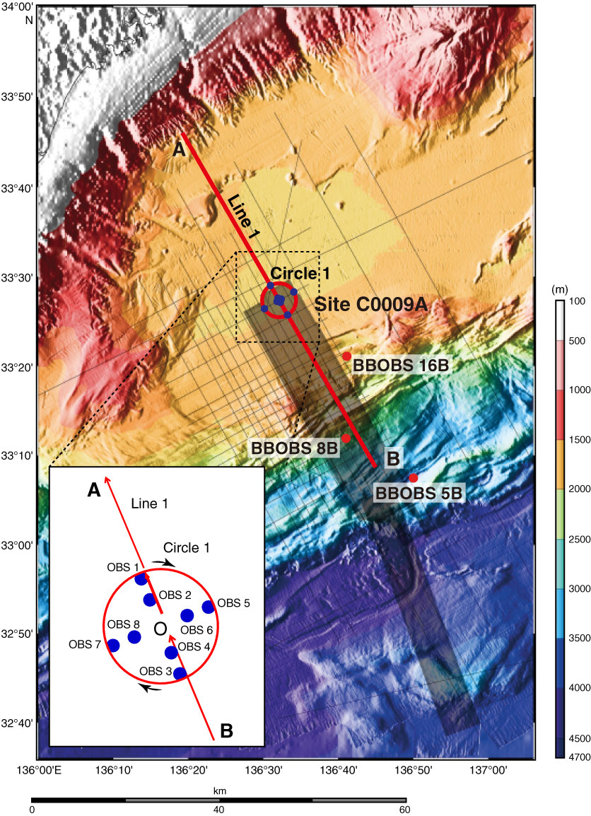
Figure F19. Location map of survey lines, Site C0009 (proposed Site NT2-11B). Line 1 shooting from southeast (B) to northwest (A), and Circle 1. Red circles = broadband ocean-bottom seismometers (BBOBSs), blue points = 8 short period ocean-bottom seismometers (OBSs) deployed by Kairei around Chikyu, thin gray lines = previous 2-D seismic surveys, shaded areas = previous 3-D and dense 2-D survey.
Previous | Close | Next | Top of page