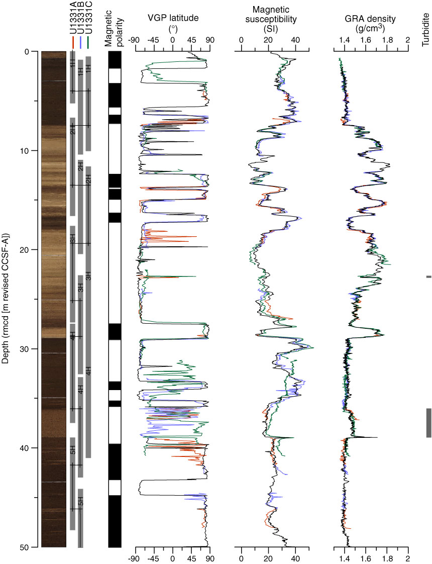
Figure F2. Site U1331 paleomagnetic and physical property data on rmcd (m revised CCSF-A) scale. Splice map and spliced core image on the left side, turbidite location on the right side. VGP = virtual geomagnetic pole, GRA = gamma ray attenuation. Red = Hole U1331A, blue = Hole U1331B, green = Hole U1331C, black = composite record. Composite record line is discontinuous because of distortion and data gaps. DI = drilled interval. (Continued on next three pages.)
Previous | Close | Next | Top of page