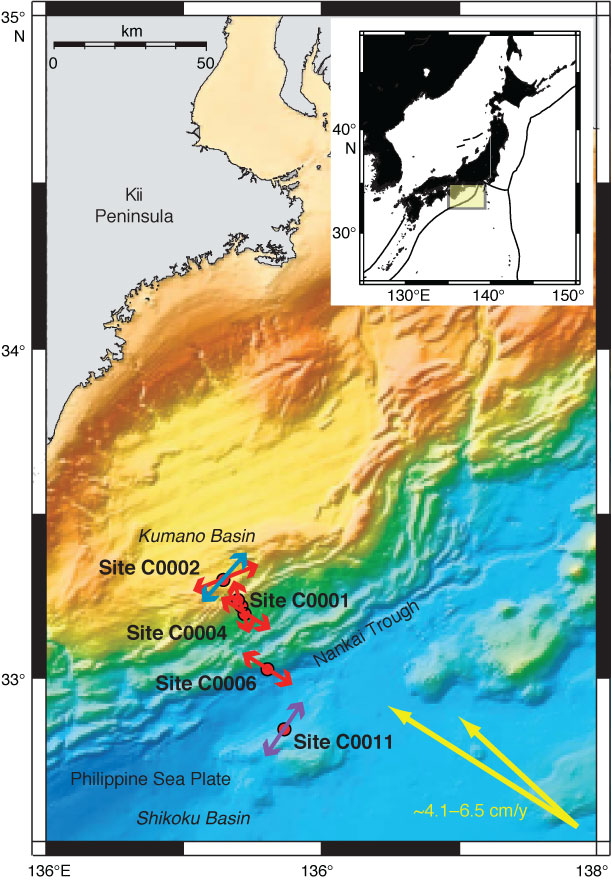
Figure F77. Bathymetric plot of the Nankai transect, with site locations from NanTroSEIZE Stage 1 and maximum horizontal compressive stress direction at each site as indicated by borehole breakouts. Site C0011 (purple arrow) has a north-northeast–south-southwest azimuth, near perpendicular to convergence direction of Philippine Sea plate (northwest–southeast) (yellow arrows) and sites within accretionary prism (red arrows). It is near-parallel to azimuth indicated in shallow sediments of Kumano Basin (blue arrow).
Previous | Close | Next | Top of page