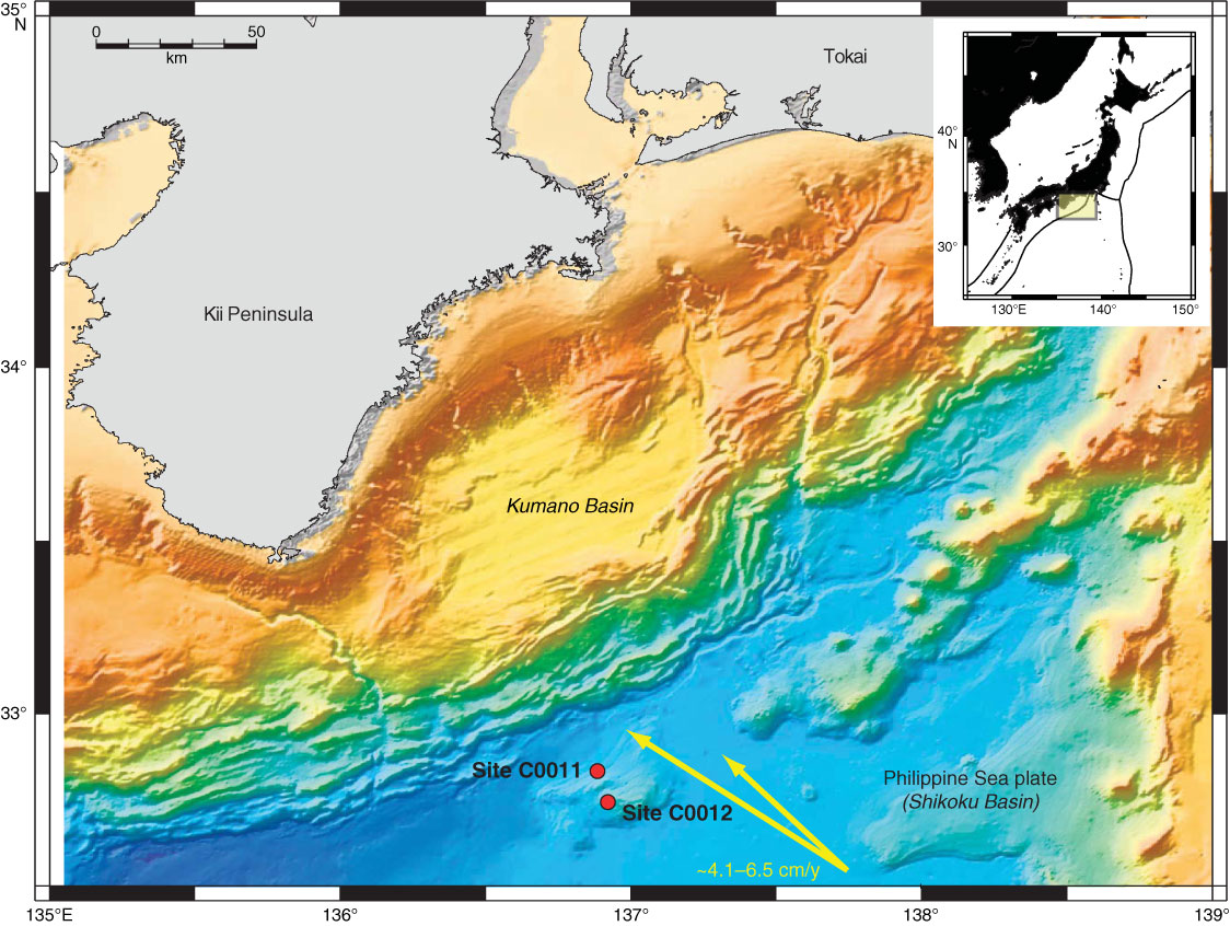
Figure F1. Bathymetric map with drilling locations of the NanTroSEIZE project offshore Kii peninsula (from the “Expedition 322 summary” chapter [Underwood et al., 2010]). Sites C0011 and C0012 are ~15 km seaward of the deformation front of the Nankai Trough subduction zone complex. Site C0011 is on the northern flank of Kashinosaki Knoll, and Site C0012 is on its crest. Yellow arrows show direction and velocity of Philippine Sea plate movement.
Close | Next | Top of page