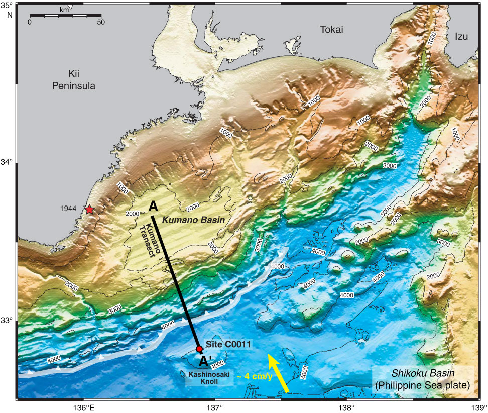
Figure F1. Bathymetry map with Expedition 322 Site C0011 (after Underwood et al., 2009). Black line (A–A′) = seismic line from the Kumano Basin to the Kashinosaki Knoll in the Shikoku Basin, white transparent line = deformation front, arrow = convergence vector between Philippine Sea plate and Japanese Islands (Eurasian plate), red star = 1944 Tonankai M 8.2 earthquake.
Close | Next | Top of page