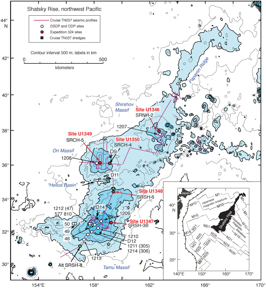
Figure F2. Location chart of major feature names (blue), the Cruise TN037 site survey seismic tracks, Cruise TN037 dredges, DSDP and ODP drill sites, and sites drilled during Expedition 324. Light blue shading = elevations shallower 5 km on Shatsky Rise. Site 1213 is the location where igneous rocks were drilled during ODP Leg 198 (Shipboard Scientific Party, 2002a). Inset illustrates the location of Shatsky Rise in relation to western Pacific magnetic lineations (thin lines), trenches (toothed line), and Japan.
Previous | Close | Next | Top of page