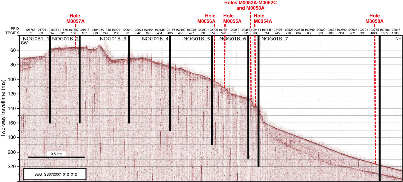
Figure F9. Topas PS18 seismic profile SEG_SS072007_012_012 showing location of proposed drill sites at transect NOG-01B, Expedition 325. Approximate location of seismic profile is shown in Figure F1 in the “Transect NOG-01B” chapter (proposed transect). Red lines = actual drill locations, solid lines = holes drilled on the seismic profile transect, dashed lines = holes drilled off the seismic profile transect.
Previous | Close | Next | Top of page