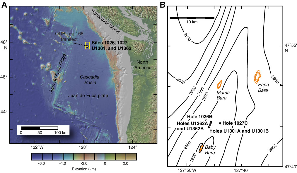
Figure F1. Maps showing locations of CORK observatories discussed in this paper. A. Regional map showing location of Ocean Drilling Program (ODP) Leg 168 transect and Integrated Ocean Drilling Program (IODP) Expedition 301 and 327 work areas. Yellow rectangle indicates area of Figure F1B. Regional map generated using GeoMapApp (www.geomapapp.org/) and the global multiresolution topography synthesis (Ryan et al., 2009). B. Site map showing locations of ODP/IODP Holes 1026B, 1027C, U1301A, U1301B, U1362A, and U1362B (see the “Site U1362” chapter; Expedition 301 Scientists, 2005b; Shipboard Scientific Party, 1997). Gold contours show locations of basement outcrops (Davis et al., 1992b; Zühlsdorff et al., 2005). Sites 1026, U1301, and U1362 are aligned above a buried basement high, where sediment thickness is 236–265 m, whereas Site 1027 is located above an area of thicker sediment and deeper basement.
Close | Next | Top of page