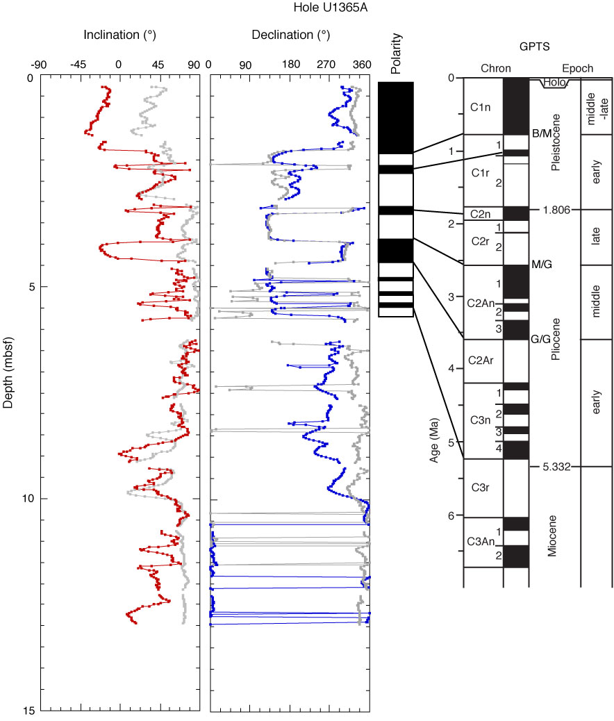
Figure F54. Interpretation of polarity stratigraphy in the geological polarity magnetic timescale (GPTS), Site U1365A. Red = inclination data, blue = declination after the 20 mT AF demagnetization step, gray = measurements before demagnetization. Declinations are oriented after orientation using the Flexit tool. B/M = Brunhes/Matuyama, M/G = Matuyama/Gauss, G/G = Gauss/Gilbert.

Previous | Close | Next | Top of page