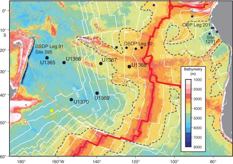
Figure F1. South Pacific seafloor bathymetry map (Smith and Sandwell, 1997) illustrating tectonic setting and Expedition 329 sites. Site U1371 (45°58′S, 163°11′W, water depth = 5310 m) is located at the southern end of the southwestern transect. White lines = basement age in 10 m.y. increments. DSDP = Deep Sea Drilling Project, ODP = Ocean Drilling Program.

Close | Next | Top of page