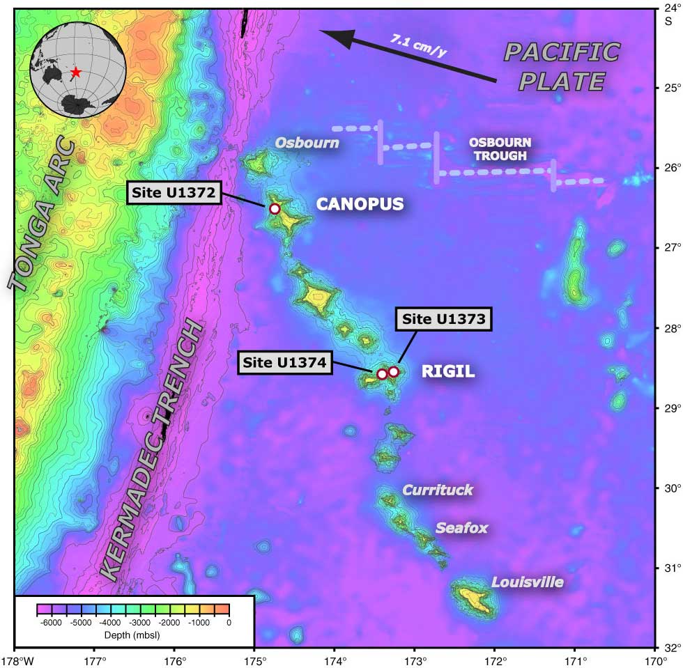
Figure F1. Bathymetric map of the old end of the Louisville Seamount Trail in the southwest Pacific, showing the location of Osbourn Guyot, Site U1372 on Canopus Guyot, and Sites U1373 and U1374 on Rigil Guyot. GMT-generated bathymetric map is based on a combination of SIMRAD EM120 multibeam data collected during the AMAT02RR site survey expedition aboard the R/V Roger Revelle and the global predicted bathymetry (v8.2) from Smith and Sandwell (1997). The current motion of the Pacific plate is indicated with the black arrow. The map uses a linear projection (i.e., horizontal and vertical scales differ) based on WGS-84.
Close | Next | Top of page