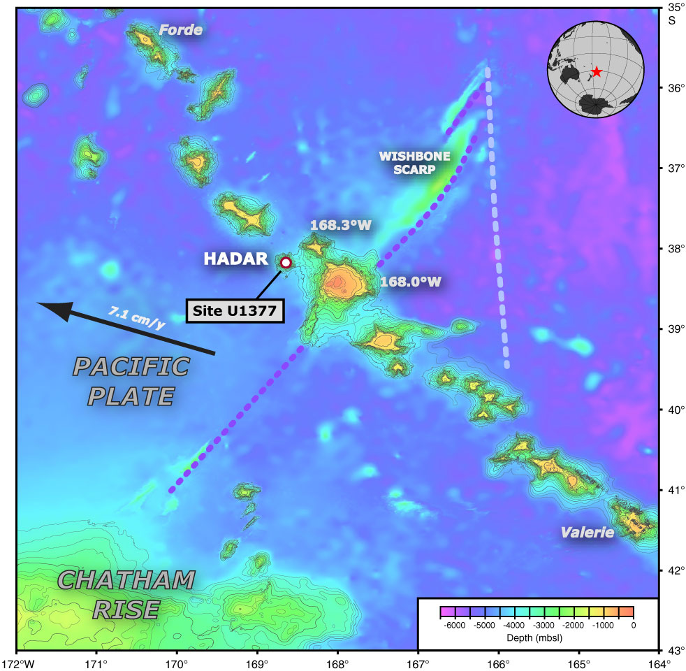
Figure F1. Bathymetric map of the Louisville Seamount Trail in the southwest Pacific, showing the location of Site U1377 on Hadar Guyot close to the Wishbone Scarp (dashed lines). GMT-generated bathymetric map is based on a combination of SIMRAD EM120 multibeam data collected during the AMAT02RR site survey expedition aboard the R/V Roger Revelle and global predicted bathymetry (v8.2) from Smith and Sandwell (1997). The current motion of the Pacific plate is indicated with the black arrow. The map uses a linear projection (i.e., vertical and horizontal scales differ) based on WGS-84.
Close | Next | Top of page