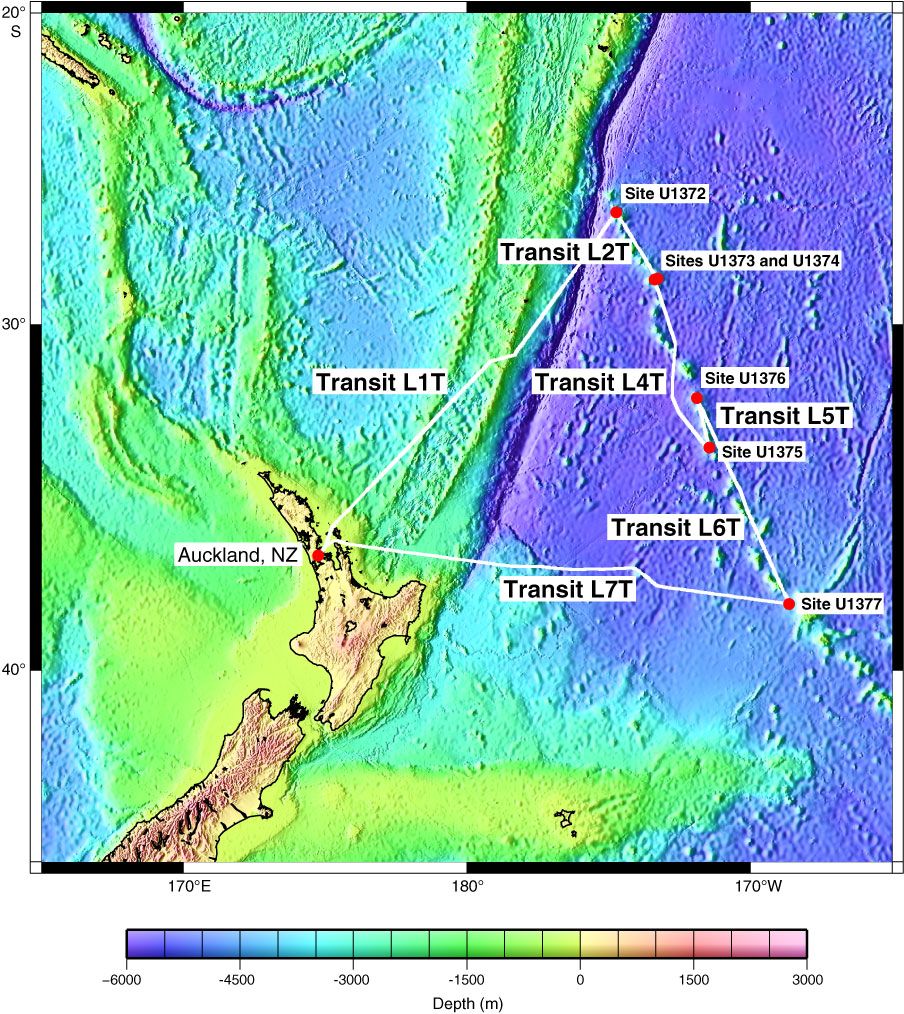
Figure F1. Location map showing geophysical track data collected during Expedition 330 to the Louisville Seamount Trail, together with the regional tectonic setting. Expedition 330 drill sites, together with the starting and ending port of Auckland, New Zealand, are marked with red dots. Heavy white lines show transit routes. Transit L3T between Sites U1373 and U1374 is too short to be visible on the map and thus is not labeled. Bathymetry is from Smith and Sandwell (1994; v12.1).
Close | Next | Top of page