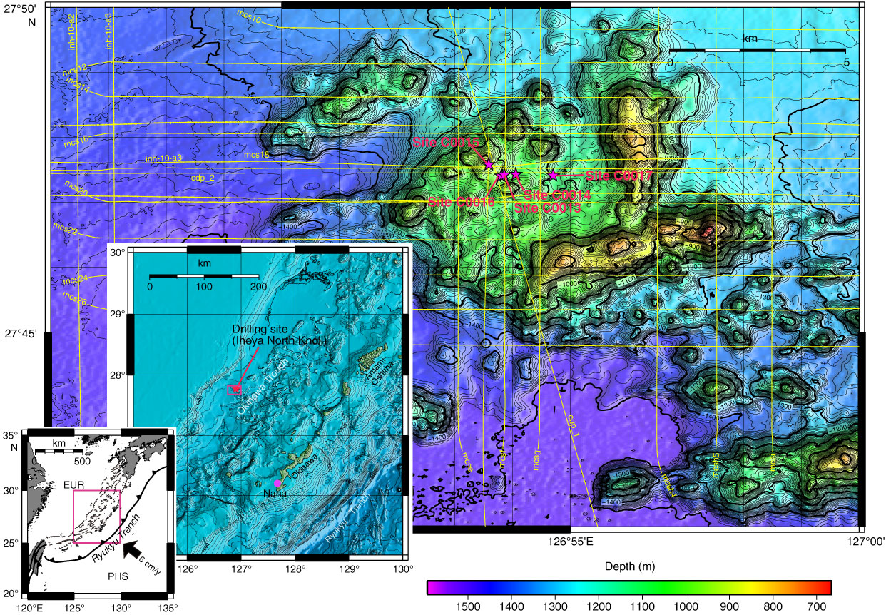
Figure F1. Area map of Iheya North Knoll showing Sites C0013–C0017 drilled during Expedition 331. Inserts show the Iheya North Knoll in relation to Okinawa and Okinawa in relation to major tectonic components. Yellow lines on the map show a grid of MCS and SCS survey lines. EUR = Eurasian plate, PHS = Philippine Sea plate.
Close | Next | Top of page