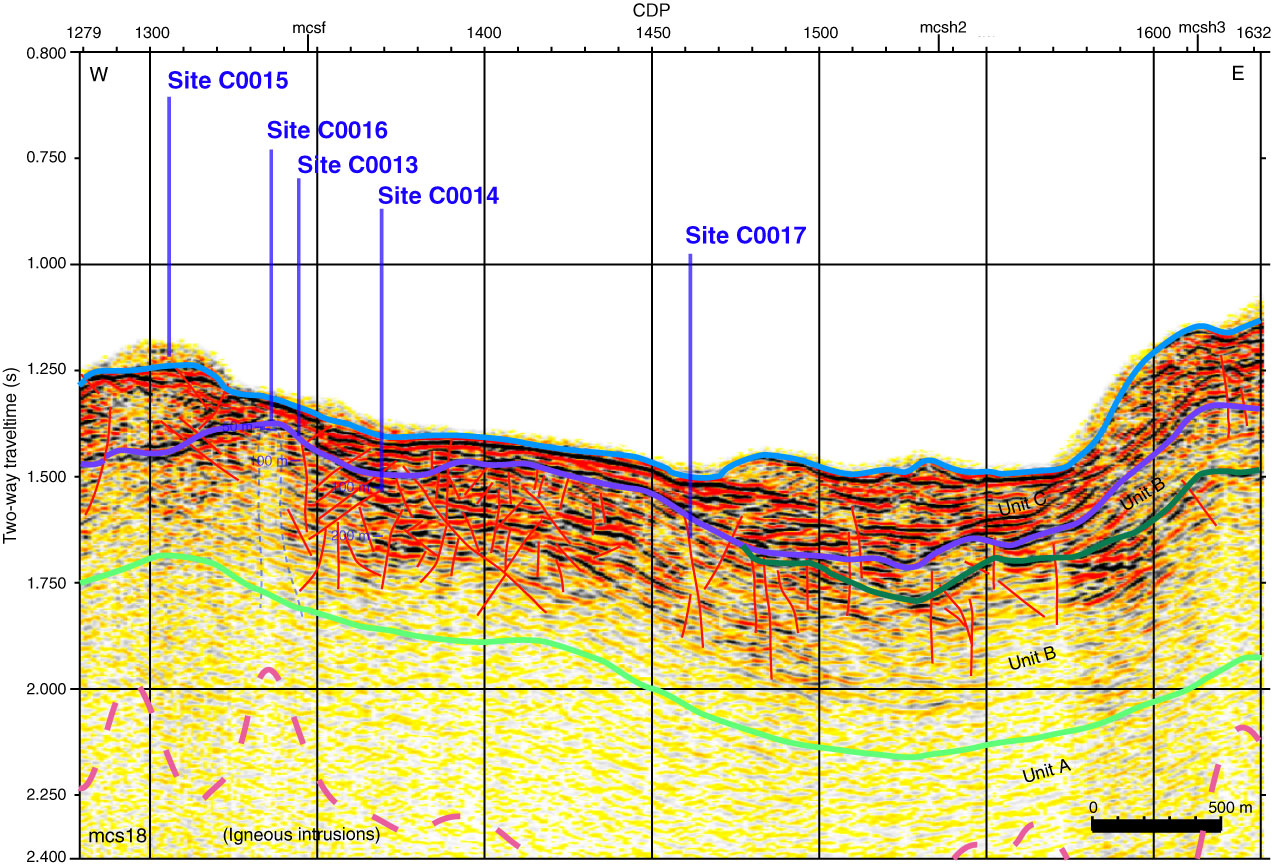
Figure F5. Cross section, looking north, of subseafloor structure of the hydrothermal field and the central valley of Iheya North Knoll based on the profile of multichannel seismic Line MCS18. Expedition 331 drilling sites and their actual drilled depths are shown as blue bars along with possible lithological interpretation assuming that 1 s two-way traveltime = 750 m. Units (A, B, and C) are those identified from the seismic reflection profile prior to drilling. Curved colored lines represent an attempt to correlate significant reflectors. CDP = common depth point.
Previous | Close | Next | Top of page