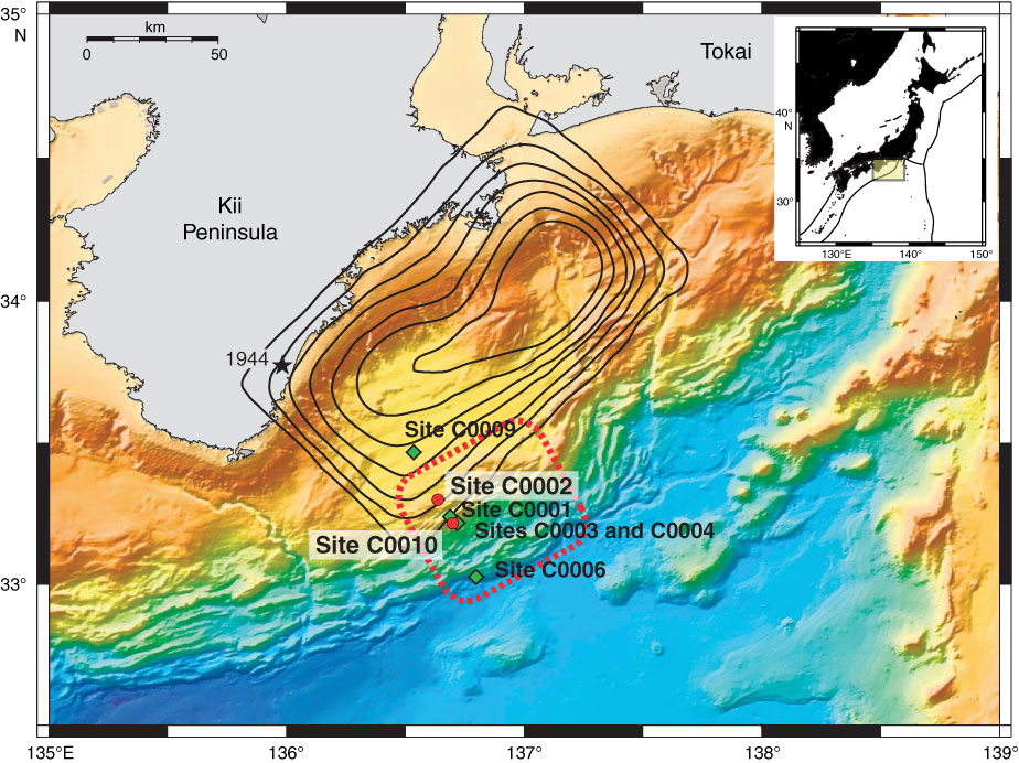
Figure F1. Map of Nankai accretionary complex off Kumano, showing NanTroSEIZE drill sites. Stars = epicenter of great earthquakes, red circles = Expedition 332 sites, green squares= previous NanTroSEIZE drill sites, black contours = estimated slip during the 1944 event (0.5 m interval), and area circled by dashed red line = occurrence of very low frequency events. Inset shows location of Nankai Trough region in relation to Japan.
Close | Next | Top of page