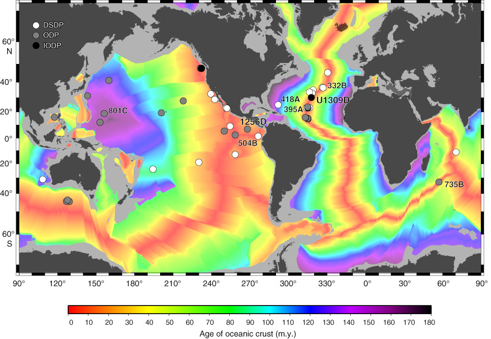
Figure F3. Map of ocean floor age, based on age grid by Müller et al. (2008, revised version 3; www.earthbyte.org/). Symbols represent DSDP, ODP, and IODP holes drilled in ocean crust >100 mbsf from 1974 to 2011. Holes deeper than 500 m in intact and rifted oceanic crust are labeled. This map does not include “hard rock” drill holes in oceanic plateaus, arc basement, hydrothermal mounds, or passive margins.
Previous | Close | Next | Top of page