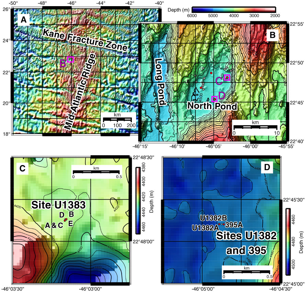
Figure F1. Location maps of Expedition 336 study sites. A. Regional overview of North Pond location on the western flank of the Mid-Atlantic Ridge, south of the Kane Fracture Zone, in the North Atlantic Ocean. B. Local bathymetric map of North Pond and the adjacent Long Pond. Red circles = Expedition 336 sites in North Pond, gray circles = former sampling locations. Contours every 100 m. C. Detailed view of the bathymetry and orientation of holes at Site U1383. Red circles = borehole observatories, gray circles = other drilled sites. D. Detailed view of the bathymetry and orientation of holes at Sites 395 and U1382. Red circles = borehole observatories, gray circles = other drilled sites.
Close | Next | Top of page