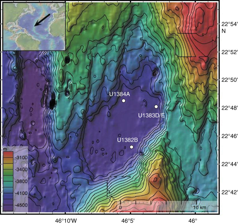
Figure F1. Bathymetric map of North Pond showing the locations of the sites sampled during Expedition 336 (white dots). Contour lines = 100 m intervals. Inset = location of North Pond field site on the western flank of the Mid-Atlantic Ridge. This map was created using the default Global Multi-Resolution Topography Synthesis basemap (Ryan et al., 2009) in GeoMapApp version 3.4.1 (http://www.geomapapp.org).
Close | Next | Top of page