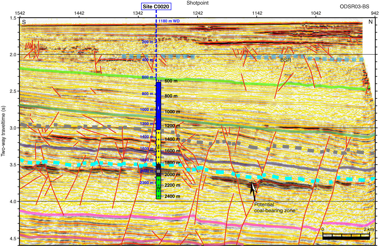
Figure F2. Seismic profile in the vicinity of Site C0020 off the Shimokita Peninsula. Gray zones = potential coal-bearing layers. WD = water depth, BSR = bottom-simulating reflector. Blue depths = estimate based on pre-expedition interpretation of seismic profile, black depths = corrected with vertical seismic profile check shot data.
Previous | Close | Next | Top of page