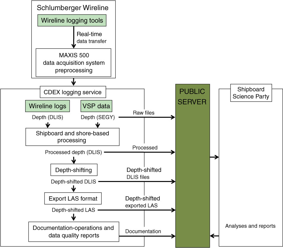
Figure F15. Diagram of shipboard data flow, Expedition 337. MAXIS = multitasking acquisition and imaging system. CDEX = Center for Deep Earth Exploration. VSP = vertical seismic profile. DLIS = digital log information standard, SEGY = Society of Exploration Geophysicists format “Y,” LAS = log ASCII standard.

Previous | Close | Next | Top of page