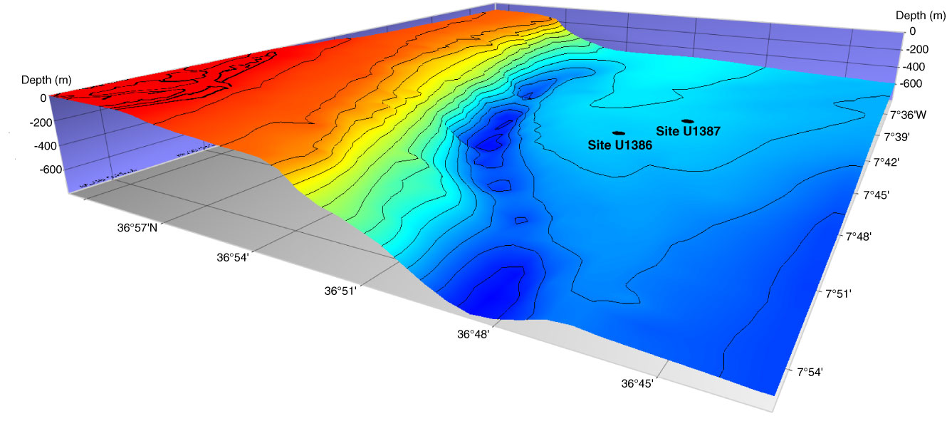
Figure F1. 3-D bathymetric map showing the northwest end of the Faro elongated, mounded, and separated drift and the location of Sites U1386 (36°49.685′N, 7°45.321′W) and U1387 (36°48.321′N, 7°43.132′W) (made by H. Pereira, Escola Secundária de Loulé, Portugal, using Mirone and iView4D software).
Close | Next | Top of page