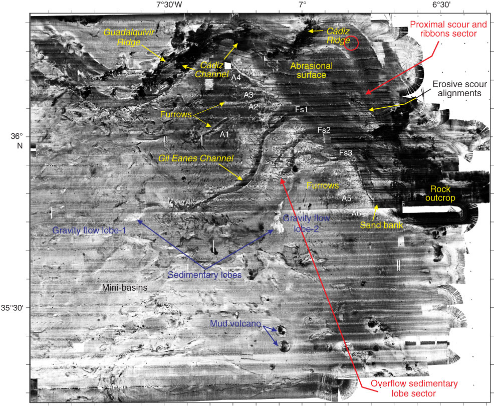
Figure F2. Original Seamap side-scan data including proximal scour and sand ribbons (Sector 1) over the contourite terrace and overflow sedimentary lobe (Sector 2). Red circle indicates location of Site U1388. Furrows legend from Kenyon and Belderson (1973) and Habgood et al. (2003). From Hernández-Molina et al. (2006). Data courtesy of Joan Gardner from Naval Research Laboratory, USA.
Previous | Close | Next | Top of page