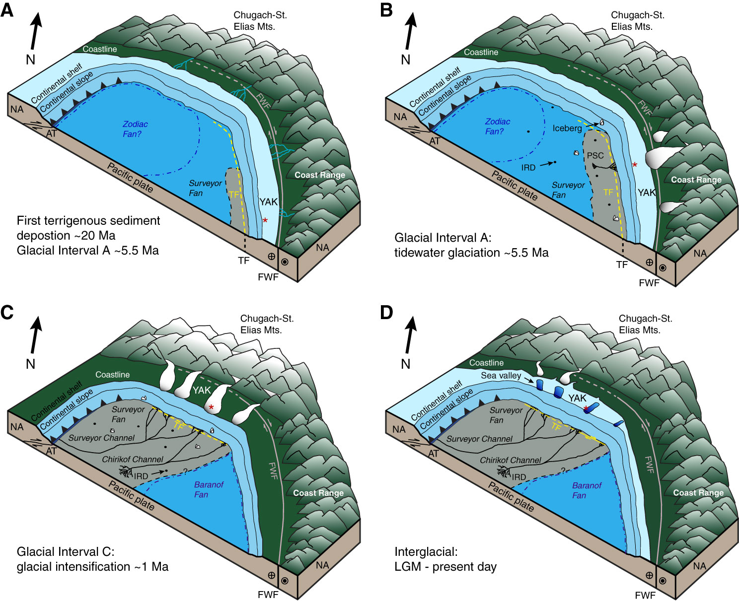
Figure F17. Schematic illustration of Surveyor Fan and southern Alaska margin sedimentary evolution over the last ~20 m.y. Gray area on seafloor represents the growth and evolution of the Surveyor Fan by channel-related processes. Red asterisk denotes the approximate location of Alsek Sea Valley through time. A. ~20–5.5 Ma. B. ~5.5 Ma. C. ~1 Ma. D. Last Glacial Maximum (LGM)–present. AT = Aleutian Trench, FWF = Fairweather Fault, IRD = ice-rafted debris, NA = North America, PSC = proto-Surveyor Channel, TF = transition fault, YAK = Yakutat Terrane. From Reece et al. (2011).

Previous | Close | Next | Top of page