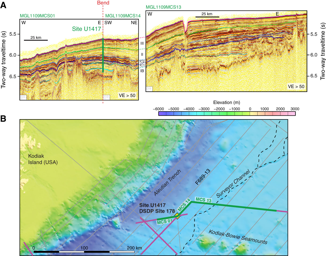
Figure F26. A. From left to right, a seismic transect from MGL1109 Line 1 toward the east, to MGL1109 Line 14 heading northeast, to MGL1109 Line 13 heading east. Seismic sequences can be mapped from Site U1417 to the Surveyor Channel. VE = vertical exaggeration. B. Multibeam bathymetry map showing location of Site U1417, DSDP Site 178, and seismic profiles relative to the Surveyor Channel, Kodiak-Bowie Seamounts, Aleutian Trench, and Kodiak Island, Alaska.
Previous | Close | Next | Top of page