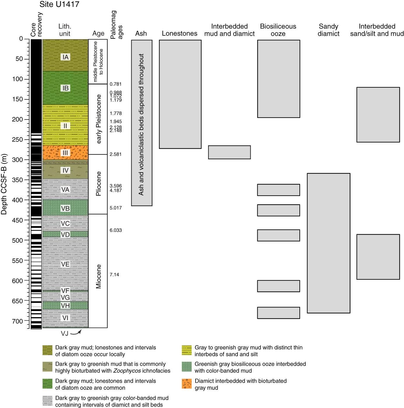
Figure F28. Site U1417 lithostratigraphic units and major lithologies used to define the lithostratigraphy, including ash and sediment containing volcaniclastic components, lonestones (>2 mm), diamict (ice-rafted interpretation), biosiliceous ooze, diamict (gravity flow interpretation), interbedded sand or silt with mud, and sand or silt beds. Data from all five holes were combined to produce a stratigraphic column showing the mid-depth location of each lithostratigraphic unit in the overall sedimentary sequence. Solid lines show where Neogene epoch boundaries coincide, or are within 10 m of a measured paleomagnetic reversal; dashed line separates the uncertain location of epoch boundaries estimated from the shipboard age model. Paleomagnetic age reversals in Ma are displayed to the right of the chronostratigraphic column.
Previous | Close | Next | Top of page