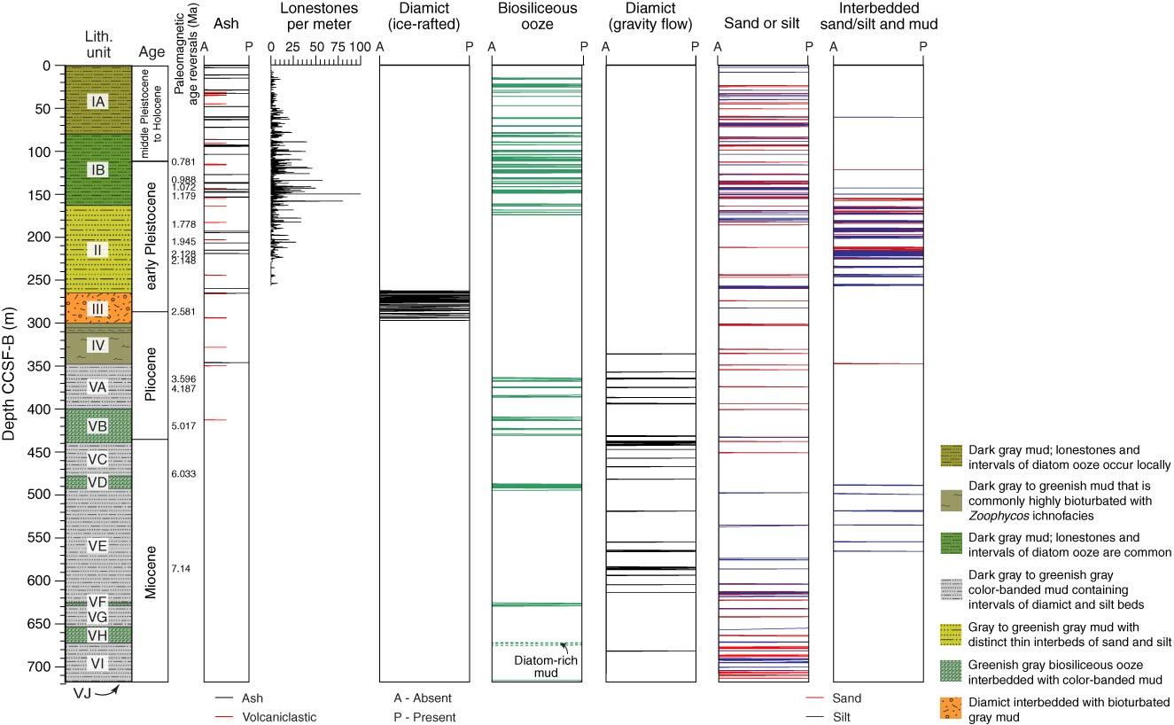
Figure F16. Schematic diagram of lithostratigraphic units and major lithologies using combined data from Holes U1417A–U1417E. Lonestone counts are the number of clasts >2 mm diameter per meter of described section. Diamict includes both ice-rafted and gravity flow interpretations. With the exception of lonestone counts, downcore profiles show the middepth location of each feature/intervals in the overall sedimentary sequence. Solid lines = Neogene epoch boundaries that coincide with or are within 10 m of a measured paleomagnetic reversal. Dashed lines = uncertain locations of epoch boundaries estimated from the shipboard age model.
Previous | Close | Next | Top of page