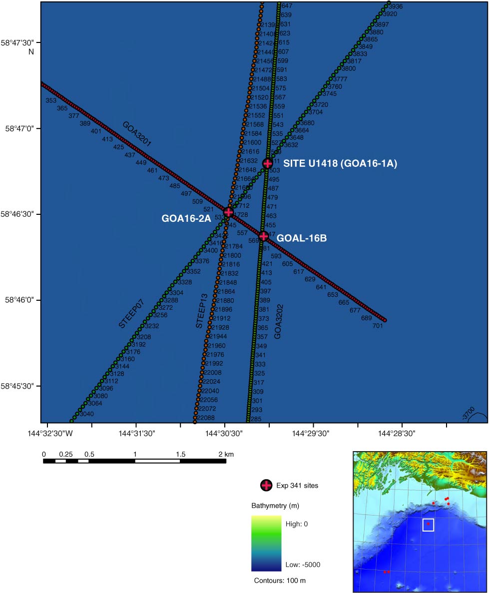
Figure F4. Navigation map, showing profiles and select shot points for two high-resolution generator-injector gun profiles, GOA3201 and GOA3202, and two crustal-scale St. Elias Erosion and Tectonics Project (STEEP) profiles, STEEP13 and STEEP07. Inset shows location of proposed Expedition 341 sites and drilled Site U1418. Common depth point locations are labeled for each line.
Previous | Close | Next | Top of page