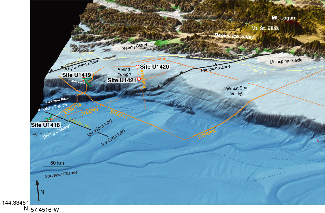
Figure F1. Perspective view of the northern Gulf of Alaska, showing major tectonic elements (black = thrust faults). Relief is shown at ~10× vertical exaggeration, with total vertical relief ranging from <4000 m below sea level to >5000 m above sea level. Orange = seismic profiles from the St. Elias Erosion and Tectonics Project (STEEP) draped over topography. Green = seismic profiles from Cruise EW0408. Black line = USGS Line F-6-89-GA-26. Figure modified from Gulick et al. (2013).
Close | Next | Top of page