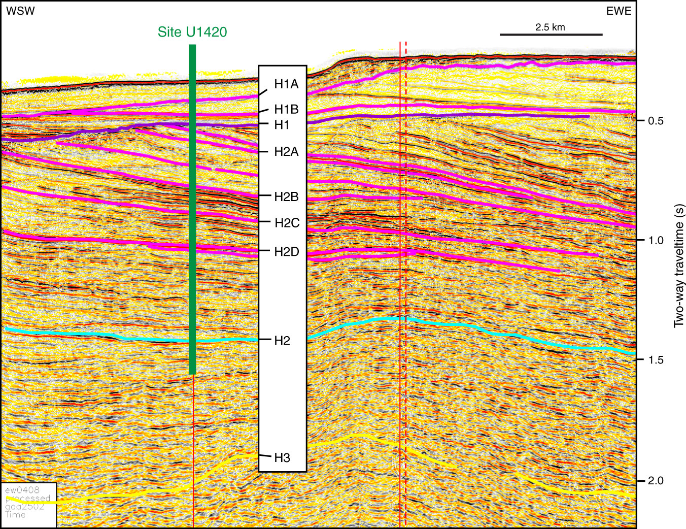
Figure F31. Seismic Profile GOA2502 acquired in 2004 aboard the R/V Maurice Ewing as part of a site survey cruise for Expedition 341. Vertical resolution at the seafloor = ~5 m. Interpretations based on Worthington et al. (2008, 2010) and Berger et al. (2008). Vertical red lines = positions of proposed (solid) and previously drilled (dashed) industry sites. Green line = position of Site U1420. See Figure F11 for ranges of possible depths of penetration of Site U1420 relative to the seismic data.
Previous | Close | Top of page