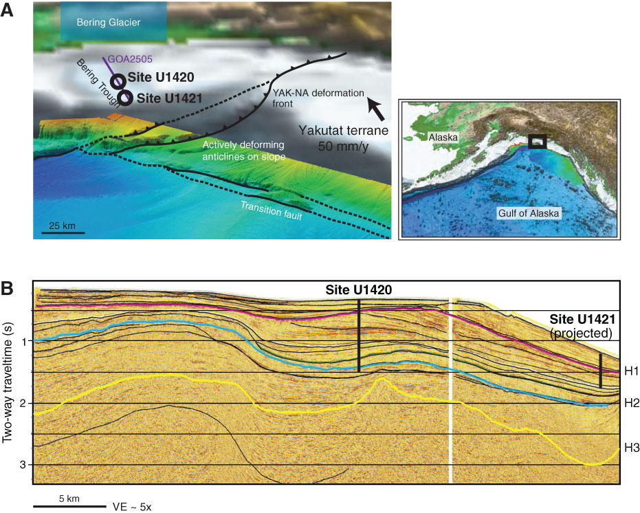
Figure F1. A. Location map showing Sites U1420 and U1421 offshore southern Alaska along with regional tectonic features. B. Seismic Line GOA2505 showing of Sites U1420 and U1421 location along with horizon interpretation. Horizon topography is related to folding and thrusting in the Pamplona zone. Images modified from Worthington et al. (2010). YAK-NA = Yakutat-North America. VE = vertical exaggeration.
Close | Next | Top of page