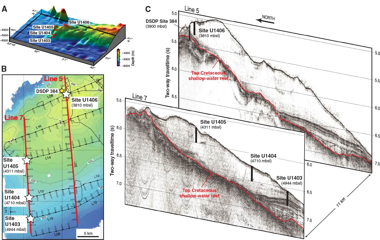
Figure F16. A. Perspective bathymetric map (view to the northwest) of J-Anomaly Ridge with locations of Sites U1403–U1406. B. Bathymetric map and seismic reflection trackline survey of the westernmost part of J-Anomaly Ridge with locations and water depths of Sites U1403–U1406. C. Perspective image of seismic reflection Lines 7 and 5 (view to the east-northeast) with positions, water depth, and approximate penetrated depths of Sites U1403–U1406 and DSDP Site 384.
Previous | Close | Next | Top of page