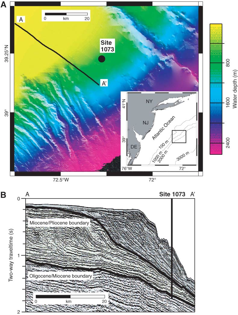
Figure F1. A. Bathymetric map of New Jersey continental slope (National Geophysical Data Center, www.ngdc.noaa.gov/mgg/bathymetry/hydro.html). ODP Leg 174A Site 1073 is located at 639 m water depth on a smooth portion of the slope (Shipboard Scientific Party, 1998). B. Two-way traveltime dip seismic Line 1002 showing regional Miocene–Pleistocene stratigraphy. Black lines identify age boundaries. In the smooth zone, Pleistocene sediments completely cover Miocene strata, whereas the Miocene is exposed where canyons are present. Modified from Dugan and Flemings (2000).
Close | Next | Top of page