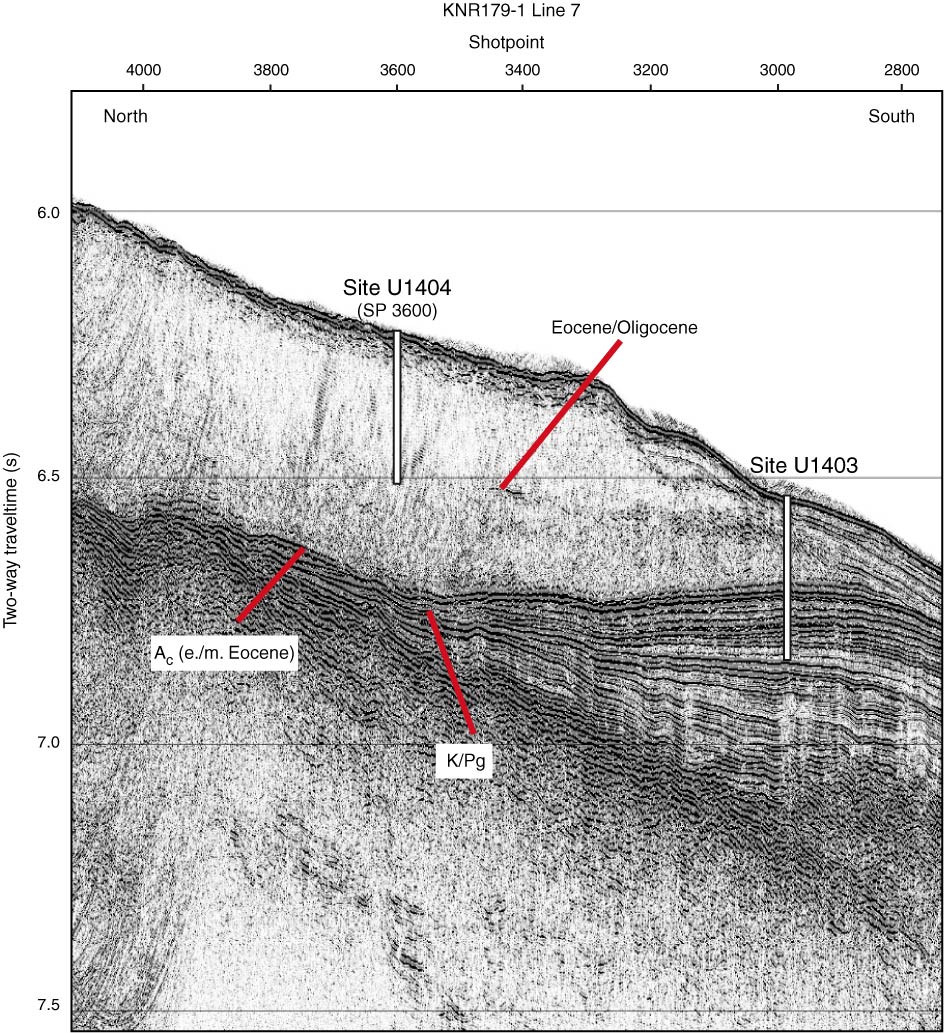
Figure F2. Single-channel seismic KNR179-1 Line 7 north–south dip line crossing Site U1404 (at shotpoint [SP] 3600). White bar represents approximate depth of penetration. Identified acoustic horizon is shown at the approximate location of the early/middle (e./m.) Eocene boundary. K/Pg = Cretaceous/Paleogene boundary.
Previous | Close | Next | Top of page