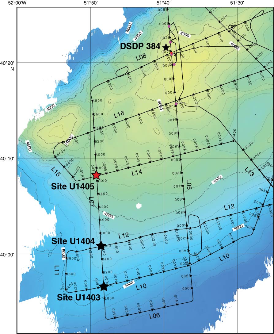
Figure F1. Bathymetric map of the southwestern end of J-Anomaly Ridge and location of Site U1405 (red star). Track lines are from a single-channel seismic survey conducted during the KNR179-1 site survey. See Figures F2, F3, and F4 for seismic profiles.
Close | Next | Top of page