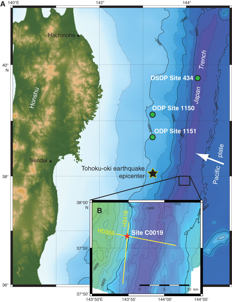
Figure F1. A. Location map, showing the eastern coastline of Honshu, bathymetry, Tohoku-oki earthquake epicenter (black star), and location of Expedition 343/343T Site C0019 (red star). Deep Sea Drilling Project (DSDP) Leg 56 Hole 434 and Ocean Drilling Program (ODP) Leg 186 Holes 1150 and 1151 (green circles) are also shown. White arrow = direction of Pacific plate convergence vector. B. Inset map shows orientation of in-line seismic section Line HD33B shown in Figure F2.
Close | Next | Top of page