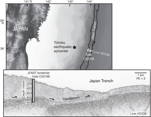
Figure F1. Map of the Tohoku area of the Japan Trench, showing the epicenter of the 2011 Tohoku earthquake, the location of Site C0019, and the location of seismic reflection Line HD33B. Lower panel is a cross-sectional profile of the toe of the Japan Trench prism, showing seismic reflection data from Line HD33B and the depth and location of the JFAST borehole, Hole C0019E. VE = vertical exaggeration. Modified from the “Expedition 343/343T summary” chapter (Expedition 343/343T Scientists, 2013a).
Close | Next | Top of page