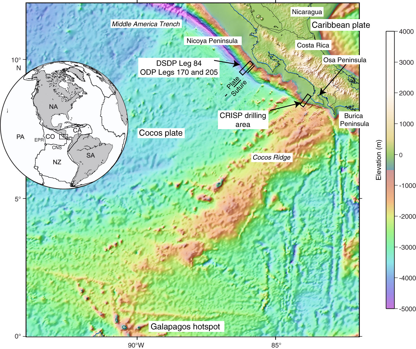
Figure F1. Topographic and bathymetric map of the Costa Rica area, showing location of Expedition 344 drilling area. Seafloor bathymetry is based on satellite gravimetry and swath mapping (Barckhausen et al., 2001; Fisher et al., 2003; von Huene et al., 2000). Note the collision of Cocos Ridge with the trench offshore of the Osa Peninsula. This process brings the seismogenic zone within reach of IODP riser drilling capabilities. DSDP = Deep Sea Drilling Project, ODP = Ocean Drilling Program. Inset shows tectonic setting of Central America, including the plates that interact in this region: North America (NA), Caribbean (CA), South America (SA), Nazca (NZ), Cocos (CO), and Pacific (PA). EPR = East Pacific Rise, CNS = Cocos-Nazca spreading center.
Close | Next | Top of page