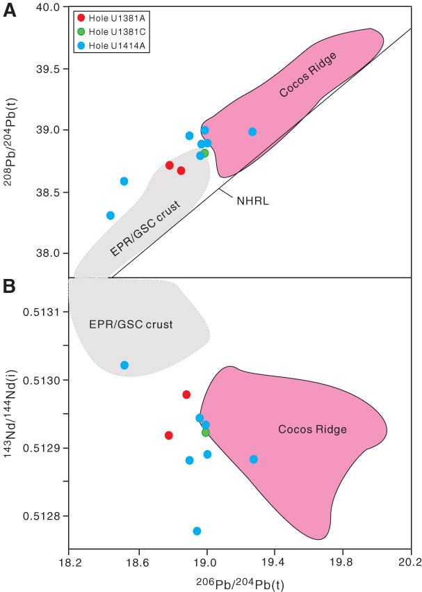
Figure F6. (A) 208Pb/206Pb(t) vs. 206Pb/204Pb(t) and (B) 143Nd/144Nd(i) vs. 206Pb/204Pb(t) diagrams for basement rocks from the CRISP-A transect drilled during Expeditions 334 and 344. The shaded field for East Pacific Rise (EPR)/Galapagos spreading center (GSC) crust is the same as in Figure F5. The pink field for Cocos Ridge is from Hoernle et al. (2004, 2008) and Gazel et al. (2009). The Northern Hemisphere reference line (NHRL) is from Hart (1984).

Previous | Close | Top of page