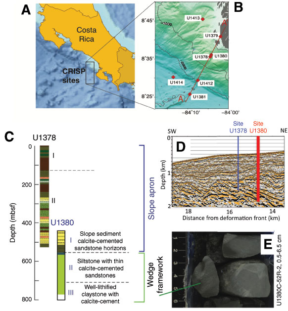
Figure F1. A. Map of the region offshore Costa Rica targeted by the IODP CRISP program. B. Sites drilled during Expeditions 334 and 344, showing location of Sites U1378 and U1380 used in this study. C. Simplified lithologic column for Sites U1378 and U1380 drilled on the middle slope. D. Location of Sites U1378 and U1380 in seismic data. Both lithologic and seismic data revealed a discontinuity between the upper sequences that correspond to slope sediment deposits and the underlying margin framework. The slope cover is ~750 m thick at Site U1378, whereas the discontinuity between slope cover and underlying framework is at 550 mbsf at Site U1380. E. Hole U1380C rocks from below 550 mbsf, described by Expedition 344 sedimentologists as calcite-cemented clastic sediment (344-U1380C-52R-2, 0.5–6.5 cm). From Expedition 334 Scientists (2012a) and Harris et al. (2013a).
Close | Next | Top of page