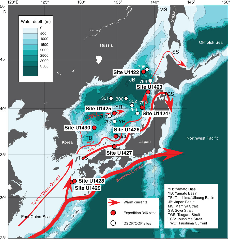
Figure F1. Bathymetric map of Expedition 346 sites (red circles) in the body of water between the Eurasian continent, the Korean Peninsula, and the Japanese Islands and the East China Sea. Sites previously drilled by the Deep Sea Drilling Project (DSDP) and Ocean Drilling Program (ODP) (white circles) are also shown. Also illustrated are the region’s surface current systems.
Close | Next | Top of page