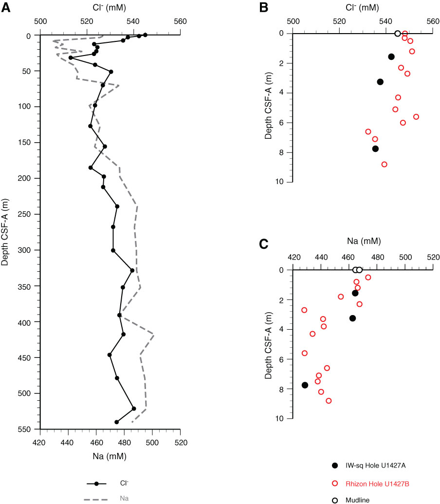
Figure F39. Dissolved chloride and sodium profiles with depth, Site U1427. A. Full depth. B. Chloride across the uppermost 10 m below the seafloor. C. Sodium across the uppermost 10 m below the seafloor. IW-sq = squeezed interstitial water.

Previous | Close | Next | Top of page