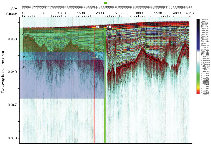
Figure F17. Correlation of seismic profile with lithostratigraphic boundaries, Site M0067. Seismic Units I, II, and III are shown in figure. Seismic Unit I corresponds to lithostratigraphic Unit I, and Seismic Units II and III correspond to lithostratigraphic Unit II. Red line indicates the proposed original site, green line indicates drilled Site M0067. SF = seafloor.

Previous | Close | Top of page