Next Section | Table of Contents
doi:10.2204/iodp.sp.301.2004
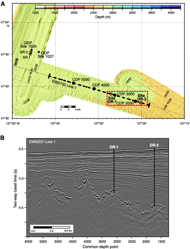
Figure F9. Deep Ridge (DR) site map and seismic data. A. DR site map. Planned DR sites are shown as stars. ODP Sites 1026 and 1027 are shown for reference, as are proposed Sites SR-1 and SR-2. B.Multichannel seismic EW0702 Line 1, showing proposed Sites DR-1 and DR-2. Both sites are positioned over buried basement highs (data courtesy of S. Carbotte and M. Nedimovic, Lamont-Doherty Earth Observatory of Columbia University, Palisades, New York, USA, and the shipboard scientific party of EW0207). CDP = common depth point.