Next Section | Table of Contents
doi:10.2204/iodp.sp.301T.2004
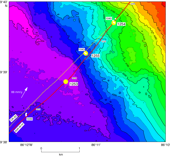
Figure F3. Bathymetric map of the Leg 205 drilling area: yellow dots = Leg 205 sites, white dots = Leg 170 sites. Seismic profiles: red = BGR 99-44 (C. Reichert and C. Ranero, pers. comm., 2001), yellow = CR-20 (Shipley et al., 1992). Leg 170 drill sites were based on seismic profile CR-20. Numbers along Line BGR 99-44 are shotpoints. White arrow = convergence direction (N30°E) and rate (88 mm/y) (DeMets et al., 1990). Bathymetric contours are in meters. (Integration of compilation by Ranero and von Huene [2000] and Simrad data from E. Flueh [pers. comm., 2000]).