Next Section | Table of Contents
doi:10.2204/iodp.sp.309312.2005
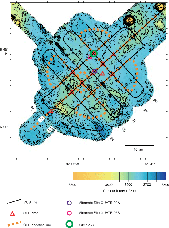
Figure F6. Bathymetry and site survey track map for Site 1256 and local, alternate single- or multibit penetration holes. Abyssal hill relief of as much as 100 m is apparent in the southwest portion of the survey area; relief to the northeast is more subdued. MCS = multichannel seismic, OBH = ocean bottom hydrophone.