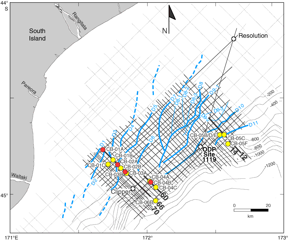
Figure F3. Proposed drill Sites CB-01A to CB-06B (primary and alternate sites marked in red and yellow, respectively) together with EW00-01 high-resolution (frequencies up to 300 Hz) MCS grid (thick straight lines), low-resolution CB-82 commercial MCS grid (thin straight lines), exploration wells Clipper and Resolution, and Ocean Drilling Program (ODP) Site 1119. The EW00-01 survey provided improved vertical resolution (~5 m in the upper 1 s) for defining high-frequency sedimentary sequences. Also shown is the distribution of seismically resolvable sediment drifts (Drifts D1–D11; blue curved lines mark crests of the drift mounds). Drifts D1–D6 and D10–D11 are simple elongate drifts. Drifts D7–D9 are complex drifts. Drift D8 has three subcrests (D8-1, D8-2, and D8-3) and is a multicrested complex drift. Drift D9 is multistage drift with superimposed Subdrifts D9-1, D9-2, and D9-3. Dashed blue lines = drifts identified on CB-82 profiles. Thick black lines = locations of dip profiles on which sites are located (12, 14, 60, and 66). Bathymetric contours are in meters.
Previous | Close | Next | Top of page