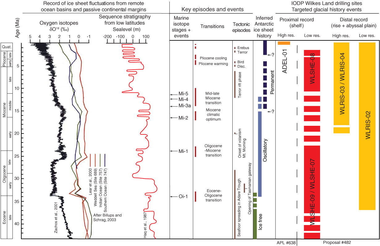
Figure F11. Stratigraphic intervals targeted by drilling a shelf to abyssal plain transect in the eastern Wilkes Land margin. The targeted intervals are designed to provide direct constrains on Antarctic ice sheet behavior and related changes in sea level, which are now mostly interpreted from the oxygen isotope record from remote oceans and from passive continental margins (modified from ANDRIL International Science Proposal, 2003). Quat. = Quaternary, Disc. = Discovery, res. = resolution, IODP = Integrated Ocean Drilling Program.
Previous | Close | Next | Top of page