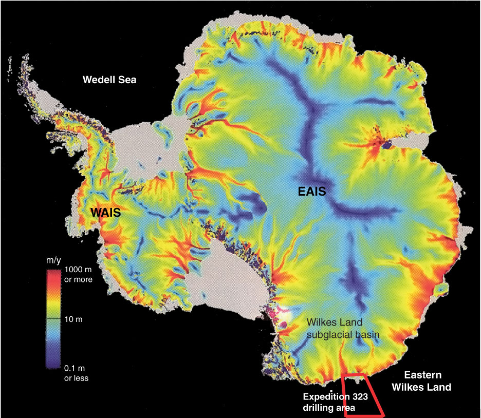
Figure F4. Map of Antarctica showing drainage patterns of the West Antarctic Ice Sheet (WAIS) and the East Antarctic Ice Sheet (EAIS) from the interior to the coast. Red = areas of fast flowing ice streams. Also shown is the drilling area, which partly drains the Wilkes Subglacial Basin, where the EAIS is partly grounded below sea level.
Previous | Close | Next | Top of page