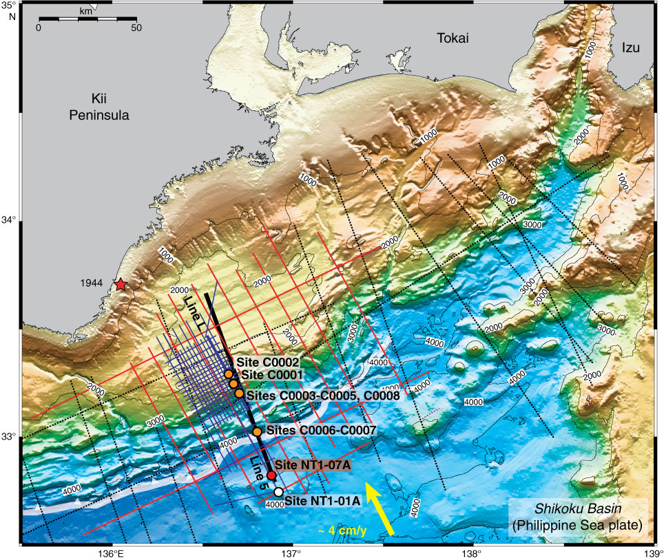
Figure F1. (continued) B. Bathymetric map, with all multichannel seismic profile locations and drill sites (Stage 1 and Stage 2). Expedition 322 will occupy proposed Site NT1-07A and contingency proposed Site NT1-01A. Portions of Line 5 are shown in Figure F2. White barbed line = position of deformation front of accretionary prism, arrow = convergence vector between Philippine Sea plate and Japanese Islands (Eurasian plate). Red dot = planned drilling Site NT1-07A, orange dots = Stage 1 sites, white dot = planned contingency Site NT1-01A.
Previous | Close | Next | Top of page